
In every virtually industry that relies on spatial data—construction, architecture, surveying, logistics, manufacturing—accuracy is not a luxury. A miscalculation of a few millimetres can cascade into structural flaws, budget overruns, scheduling delays, and safety hazards.
Today, professional grade distance measurement tools—from laser distance meters (LDM),total stations,3D laser scanners and GPS assisted rangefinders—are redefining what “precision” means on the job site. This article explores how these advanced instruments boost work accuracy, streamline workflows, and deliver measurable returns on investment.
1. Core Technologies Driving Accuracy
Modern distance measurement instruments rely on a combination of physics and signal processing. The most widespread technologies include:
● Time of Flight (ToF) Laser Rangefinding – Emits a pulsed laser beam and measures the time taken for the reflection to return. With advanced clock circuitry, today’s handheld LDMs achieve ±1.0 mm accuracy over distances up to 200 metres indoors, and ±2.0 mm over 300 metres with reflective targets.
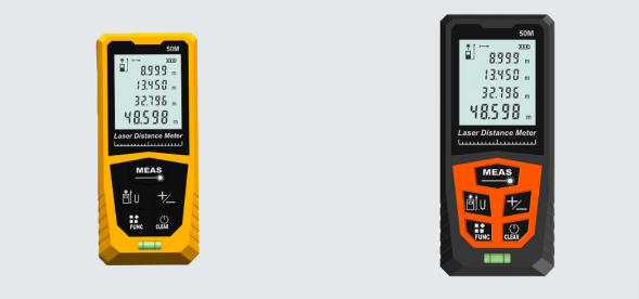
● Phase Shift Measurement – Uses continuous wave modulation to compare the phase of emitted and received light. This method excels in short to medium ranges (up to 500 m) and delivers sub millimetre resolution, making it ideal for interior finishing, machine alignment, and quality control.
● Total Station Theodolites – Combine electronic distance measurement (EDM) with angular encoders. They measure both horizontal and vertical angles alongside slope distance, enabling precise 3D coordinate positioning. Modern robotic total stations auto track prisms, allowing a single operator to survey complex sites with angular accuracy as fine as 0.5 arc seconds.
● 3D Laser Scanners (LiDAR) – Capture millions of points per second, creating dense point clouds that represent entire environments. While not a single distance tool, scanners provide holistic accuracy by cross referencing thousands of measurements, significantly reducing outlier impact.
● GNSS/RTK Equipped Rangefinders – For open field applications, satellite corrected tools offer centimetre level precision by leveraging real time kinematic corrections, bypassing the need for line of sight between points.
2. How Professional Tools Translate into Tangible Accuracy Gains
Accuracy is not an abstract metric—it manifests in concrete operational outcomes:
a) Elimination of Cumulative Error
When measuring long distances in segments (e.g., 10 metre tape sections across a 100 metre building), each segment carries its own error. These errors add up. A professional laser measures the entire span in one shot, reducing total propagated uncertainty by an order of magnitude.
b) Consistent Repeatability
Human operators vary. Fatigue, lighting, and posture affect tape readings. Digital instruments produce identical results regardless of who holds the device, as long as they follow correct aiming procedures. This repeatability is critical for handover inspections, compliance verification, and dispute resolution.
c) Integrated Data Logging
Most professional models feature onboard memory or Bluetooth/Wi Fi connectivity. Measurements are stored with timestamps and metadata, then exported directly to CAD, BIM, or spreadsheet software. This eliminates transcription errors and creates an auditable trail—essential for quality assurance and liability protection.
d) Indirect Measurement Capabilities
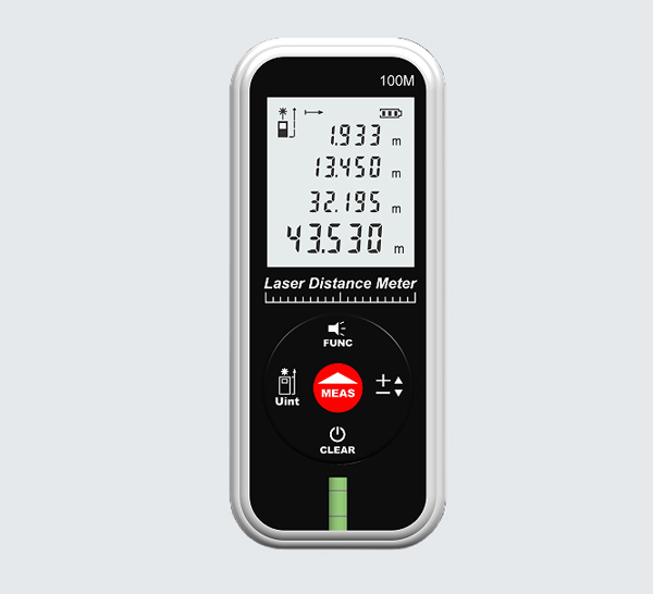
Advanced LDMs compute heights, areas, volumes, and even missing sides using Pythagoras based triangulation. For instance, measuring the height of a tall ceiling without a ladder—by taking two slant distances and the included angle—removes both safety risks and geometric guesswork.
3. Industry Specific Applications and Accuracy Requirements
Different sectors demand different levels of precision. Professional grade tools are designed with adaptable accuracy tiers:
| Industry | Typical Accuracy Need | Recommended Tool |
| Interior drywall / partitioning | ±1.5 mm | Handheld phase shift LDM |
| Structural steel erection | ±1.0 mm over 50 m | Robotic total station |
| Road / bridge construction | ±5 mm over 200 m | Reflectorless total station |
| Factory layout & machine installation | ±0.5 mm | High end LDM with tripod mount |
| Topographic mapping | ±2 cm horizontal / ±3 cm vertical | RTK GNSS rover + laser rangefinder |
| As built BIM verification | ±2 mm over full floor | 3D terrestrial scanner |
In each case, the tool does not merely “measure”—it provides real time feedback, often with visual targeting (red dot pointers, digital viewfinders, or camera zoom) that ensures the measurement point is exactly where the operator intends.
4. Beyond the Number: Workflow Efficiency and Error Prevention
Accuracy is inseparable from productivity. A tool that reduces rework by 80 % directly improves profit margins. Consider these practical benefits:
● Fewer site visits – One precise measurement trip replaces multiple verification visits.
● Faster layout – With continuous measurement modes (tracking), operators can mark positions in seconds rather than minutes.
● Remote operation – Bluetooth connected apps allow measurements from a safe distance, especially useful in hazardous zones (high voltage, unstable structures, or chemical areas).
● Automatic tolerance alerts – Many devices can be programmed to beep or flash when a reading falls outside predefined limits, catching errors before concrete is poured or steel is cut.
Moreover, training time diminishes. Modern interfaces are menu driven, with colour screens and icon based functions, reducing the learning curve for new crew members. This democratisation of precision means that accuracy no longer depends on a single “master” surveyor—it becomes embedded in the daily routine of every technician.